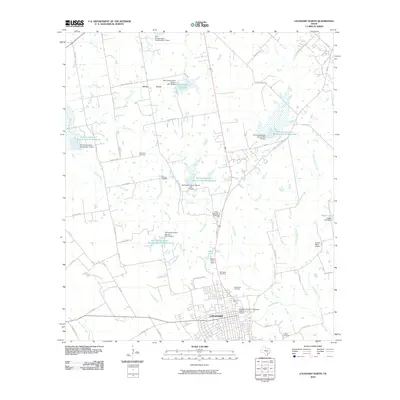
2010 Map of Lockhart North
USGS Topo · Published 2010About this map
The city of Lockhart serves as the focal point for this 2010 topographic record, specifically highlighting the Caldwell County Courthouse Historic District as its architectural and civic heart. The surrounding rural landscape in Caldwell County is defined by a sophisticated water management system comprising numerous Soil Conservation Service reservoirs and dams, such as Soil Conservation Service Site 20 Reservoir and Soil Conservation Service Site 14 Reservoir. These structures sit along the winding paths of Plum Creek and its tributaries, including Elm Creek and Boggy Creek.
Find a feature on this map
67 named features on this map. Tap any name to fly to it.
Don’t see what you’re looking for? This feature index may not catch every label — zoom into the map to look around manually.
Map Details
Editions of this 2010 Lockhart North Map
This is the sole edition of this map. No revisions or reprints were ever made.
Other maps of this area

1896 · Austin
USGS Topo · 1:125,000

1897 · Austin
USGS Topo · 1:125,000

1910 · Austin
USGS Topo · 1:125,000

1911 · San Marcos
USGS Topo · 1:125,000

1919 · San Marcos
USGS Topo · 1:125,000

1925 · San Marcos 1-d
USGS Topo · 1:48,000

1930 · Lockhart
USGS Topo · 1:62,500

1953 · Seguin
USGS Topo · 1:250,000

1954 · Austin
USGS Topo · 1:250,000

1955 · Montopolis
USGS Topo · 1:62,500