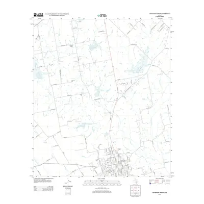
2013 Map of Lockhart North
USGS Topo · Published 2013About this map
The Caldwell County Courthouse Historic District anchors the southern portion of this map, reflecting the civic heart of Lockhart. The landscape is characterized by a dense network of watercourses, with Plum Creek and its many tributaries, such as Elm Creek and Brushy Creek, carving through the terrain. A series of flood control structures, including the Soil Conservation Service Site 14 Reservoir and Soil Conservation Service Site 21 Reservoir, demonstrate twentieth-century efforts to manage the local watershed. Genealogists will find significant value in the numerous burial sites across the area, from the Ohlendorf Cem near the former settlement of Polonia to the Guadalupe Cem and Hooks Cem further south. The transition from rural homesteads like Withers Hollow to the established streets of the county seat reveals the region's long-standing agricultural and administrative importance.
Find a feature on this map
106 named features on this map. Tap any name to fly to it.
Don’t see what you’re looking for? This feature index may not catch every label — zoom into the map to look around manually.
Map Details
Editions of this 2013 Lockhart North Map
This is the sole edition of this map. No revisions or reprints were ever made.
Other maps of this area

1896 · Austin
USGS Topo · 1:125,000

1897 · Austin
USGS Topo · 1:125,000

1910 · Austin
USGS Topo · 1:125,000

1911 · San Marcos
USGS Topo · 1:125,000

1919 · San Marcos
USGS Topo · 1:125,000

1925 · San Marcos 1-d
USGS Topo · 1:48,000

1930 · Lockhart
USGS Topo · 1:62,500

1953 · Seguin
USGS Topo · 1:250,000

1954 · Austin
USGS Topo · 1:250,000

1955 · Montopolis
USGS Topo · 1:62,500