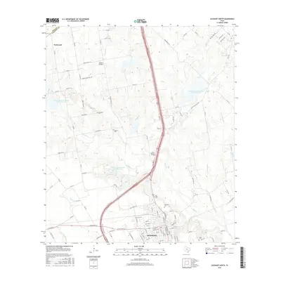
2016 Map of Lockhart North
USGS Topo · Published 2016About this map
The northern edge of Lockhart anchors this landscape, where the town grid transitions into the cattle country and prairie of Caldwell County. This 2016 survey shows a territory defined by its watercourses and family legacy, with prominent ranch roads like Simmons Family Ranch Rd and Rogers Ranch RD traversing the terrain near Withers Hollow. To the north, the small settlement of Niederwald sits near the border of Hays County, while the central portion of the map is dominated by a series of water management sites, including Soil Conservation Service Site 14 Reservoir and Soil Conservation Service Site 15 Reservoir. These reservoirs along Plum Cr and its tributaries reflect the modern agricultural and flood-control infrastructure of the Texas Blackland Prairies. Genealogists will find several notable burial grounds, such as Polonia Cem and Ohlendorf Cem, providing critical links to the area's rural heritage.
Find a feature on this map
114 named features on this map. Tap any name to fly to it.
Don’t see what you’re looking for? This feature index may not catch every label — zoom into the map to look around manually.
Map Details
Editions of this 2016 Lockhart North Map
This is the sole edition of this map. No revisions or reprints were ever made.
Other maps of this area

1896 · Austin
USGS Topo · 1:125,000

1897 · Austin
USGS Topo · 1:125,000

1910 · Austin
USGS Topo · 1:125,000

1911 · San Marcos
USGS Topo · 1:125,000

1919 · San Marcos
USGS Topo · 1:125,000

1925 · San Marcos 1-d
USGS Topo · 1:48,000

1930 · Lockhart
USGS Topo · 1:62,500

1953 · Seguin
USGS Topo · 1:250,000

1954 · Austin
USGS Topo · 1:250,000

1955 · Montopolis
USGS Topo · 1:62,500