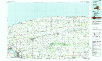
1984 Map of Lockport
USGS Topo · Published 1985About this map
Lockport and its surrounding agricultural plains appear during a period of industrial transition in the mid-1980s. The landscape is defined by the convergence of major transportation and conservation efforts, where the Conrail lines and the Thruway bridge the distance between the urban centers of Niagara Falls and Batavia. Northward, the shoreline of Lake Ontario is marked by a string of recreational sites including Lakeside Beach State Park and Golden Hill State Park, providing a sharp contrast to the dense drainage networks of Oak Orchard Creek and Eighteenmile Creek.
Find a feature on this map
227 named features on this map. Tap any name to fly to it.
Don’t see what you’re looking for? This feature index may not catch every label — zoom into the map to look around manually.
Map Details
Editions of this 1984 Lockport Map
2 editions found
Other maps of this area

1894 · Buffalo
USGS Topo · 1:62,500

1894 · Niagara Falls
USGS Topo · 1:62,500

1894 · Wilson
USGS Topo · 1:62,500

1896 · Niagara Falls
USGS Topo · 1:62,500

1897 · Tonawanda
USGS Topo · 1:62,500

1897 · Albion
USGS Topo · 1:62,500

1897 · Olcott
USGS Topo · 1:62,500

1897 · Medina
USGS Topo · 1:62,500

1897 · Lockport
USGS Topo · 1:62,500

1897 · Oak Orchard
USGS Topo · 1:62,500