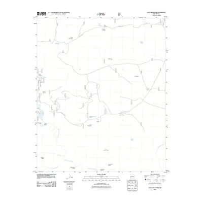
2011 Map of Loco Mountain
USGS Topo · Published 2011About this map
Loco Mountain dominates the central landscape of this Catron County survey, situated within a complex network of high mesas and deep drainage basins. The area is defined by its water management history, evidenced by numerous named stock tanks such as Three Forks Tank, Loco Mountain Tank, and Juniper Tank that dot the terrain. To the west, Snow Lake and the Snow Lake Dam sit at the headwaters of Gilita Creek, which feeds into the Middle Fork Gila River. The mapping of features like Aeroplane Mesa, Clayton Mesa, and T Bar Ridge illustrates the distinctive topographical benching of this region. Early infrastructure is represented by the Loco Mountain Rd and Forest Rd 851, while canyon names like School Canyon and Pitchfork Canyon suggest the historic ranching and local utility of the land during the early twenty-first century.
Find a feature on this map
34 named features on this map. Tap any name to fly to it.
Don’t see what you’re looking for? This feature index may not catch every label — zoom into the map to look around manually.
Map Details
Editions of this 2011 Loco Mountain Map
This is the sole edition of this map. No revisions or reprints were ever made.
Other maps of this area

1910 · Mogollon
USGS Topo · 1:125,000

1911 · Alum Mountain
USGS Topo · 1:125,000

1912 · Mogollon
USGS Topo · 1:125,000

1913 · Alum Mountain
USGS Topo · 1:125,000

1915 · Reserve
USGS Topo · 1:125,000

1918 · Pelona
USGS Topo · 1:125,000

1918 · Reserve
USGS Topo · 1:125,000

1954 · Clifton
USGS Topo · 1:250,000

1957 · Clifton
USGS Topo · 1:250,000

1958 · Clifton
USGS Topo · 1:250,000