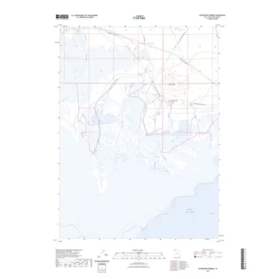
2023 Map of Locomotive Springs
USGS Topo · Published 2023About this map
Locomotive Springs and its complex network of sloughs and springs dominate this coastal stretch of the northern Great Salt Lake. The landscape transition from the higher elevations of Indian Hill and Curlew Valley down into the marshy lowlands of Spring Bay is marked by a unique hydrographic system. Numerous named water sources, including West Locomotive Spring, Teal Spring, and Bar M Spring, feed into a vast wetland area characterized by features like West Locomotive Slough, Baker Slough, and Sparks Slough.
Find a feature on this map
24 named features on this map. Tap any name to fly to it.
Don’t see what you’re looking for? This feature index may not catch every label — zoom into the map to look around manually.
Map Details
Editions of this 2023 Locomotive Springs Map
This is the sole edition of this map. No revisions or reprints were ever made.
Other maps of this area

1954 · Brigham City
USGS Topo · 1:250,000

1958 · Brigham City
USGS Topo · 1:250,000

1959 · Kelton Pass
USGS Topo · 1:62,500

1962 · Brigham City
USGS Topo · 1:250,000

1968 · Monument Point
USGS Topo · 1:24,000

1968 · Coyote Point
USGS Topo · 1:24,000

1968 · Monument Peak SW
USGS Topo · 1:24,000

1968 · Monument Peak
USGS Topo · 1:24,000

1969 · Spring Bay SW
USGS Topo · 1:24,000

1969 · Locomotive Springs
USGS Topo · 1:24,000