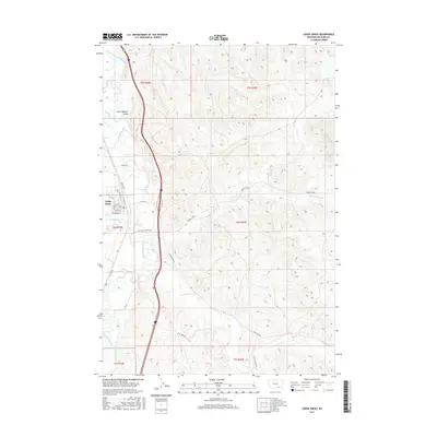
2017 Map of Lodge Grass
USGS Topo · Published 2017About this map
Lodge Grass serves as the primary hub of this landscape, situated along the Little Bighorn River where the Little Bighorn Valley stretches through the region. The town's grid is clearly defined by residential streets such as Hester, Bryan Ave, and Main St, while Old Hwy 87 parallels the modern transportation corridor. This survey reveals a complex network of water rights and agricultural irrigation represented by the Fortymile Canal, which diverts water across the western plains.
Find a feature on this map
31 named features on this map. Tap any name to fly to it.
Don’t see what you’re looking for? This feature index may not catch every label — zoom into the map to look around manually.
Map Details
Editions of this 2017 Lodge Grass Map
This is the sole edition of this map. No revisions or reprints were ever made.
Other maps of this area

1894 · Rosebud
USGS Topo · 1:125,000

1901 · Rosebud
USGS Topo · 1:125,000

1954 · Hardin
USGS Topo · 1:250,000

1957 · Hardin
USGS Topo · 1:250,000

1958 · Hardin
USGS Topo · 1:250,000

1967 · Lodge Grass NE
USGS Topo · 1:24,000

1967 · Kid Creek
USGS Topo · 1:24,000

1967 · Wolf Mountain Lookout
USGS Topo · 1:24,000
1967 · Wyola
USGS Topo · 1:24,000
1967 · Benteen
USGS Topo · 1:24,000