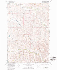
1967 Map of Lodge Grass NE
USGS Topo · Published 1986About this map
The Crow Indian Reservation landscape of Big Horn County is defined by the winding drainages of Reno Creek and its southern tributaries. Based on 1966 aerial photography and 1967 field checks, this survey documents a period when the terrain was primarily managed for grazing and resource exploration, as evidenced by a Jeep Trail and a Drill Hole in the central uplands.
Find a feature on this map
10 named features on this map. Tap any name to fly to it.
Don’t see what you’re looking for? This feature index may not catch every label — zoom into the map to look around manually.
Map Details
Editions of this 1967 Lodge Grass NE Map
3 editions found
Other maps of this area

1894 · Rosebud
USGS Topo · 1:125,000

1901 · Rosebud
USGS Topo · 1:125,000

1954 · Hardin
USGS Topo · 1:250,000

1957 · Hardin
USGS Topo · 1:250,000

1958 · Hardin
USGS Topo · 1:250,000

1967 · Crow Agency SE
USGS Topo · 1:24,000

1967 · Lodge Grass NE
USGS Topo · 1:24,000

1967 · Wolf Mountain Lookout
USGS Topo · 1:24,000
1967 · Benteen
USGS Topo · 1:24,000
1967 · Crow Agency
USGS Topo · 1:24,000