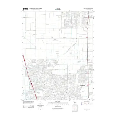
2012 Map of Lodi South
USGS Topo · Published 2012About this map
Stockton and Lodi anchor this 2012 corridor of the Central Valley, showcasing the dense residential growth of Lincoln Village and Henderson Village amidst a landscape still defined by its agricultural roots. The presence of specialized landmarks like Kaehler Dairy and Castelanelli Brothers Dairy underscores the regional importance of the dairy industry, even as suburban subdivisions press against the traditional farm plots. This interface between urban expansion and rural production is clearly visible in the transition from the orderly streets of Monada to the open fields surrounding Tomspur.
Find a feature on this map
36 named features on this map. Tap any name to fly to it.
Don’t see what you’re looking for? This feature index may not catch every label — zoom into the map to look around manually.
Map Details
Editions of this 2012 Lodi South Map
This is the sole edition of this map. No revisions or reprints were ever made.
Other maps of this area

1894 · Lodi
USGS Topo · 1:125,000

1908 · Waterloo
USGS Topo · 1:31,680

1908 · Lockeford
USGS Topo · 1:31,680

1910 · New Hope
USGS Topo · 1:31,680

1910 · Castle
USGS Topo · 1:31,680

1910 · Woodbridge
USGS Topo · 1:31,680

1910 · Headreach
USGS Topo · 1:31,680

1913 · Stockton
USGS Topo · 1:31,680

1913 · Holt
USGS Topo · 1:31,680

1914 · Burnham
USGS Topo · 1:31,680