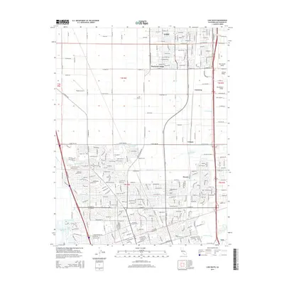
2015 Map of Lodi South
USGS Topo · Published 2015About this map
Lodi anchors the northern edge of this San Joaquin Valley survey, where the expanding suburbs of Henderson Village meet the agricultural expanse of the Central Valley. The landscape is defined by a dense network of water management features, including the Mokelumne Aqueduct and numerous waterways such as Bear Creek and Mosher Slough. This map documents a transitional period where industrial and educational hubs like Humphreys College-Stockton and the Lodi Airport are integrated into a residential fabric that stretches toward the Calaveras River. To the east, smaller settlements like Armstrong and Tomspur sit along the primary transit corridors, while the western portion remains more open, characterized by aviation facilities like Kingdon Airpark. The intricate mapping of residential streets alongside older sloughs provides a clear view of how water drainage and urban development have shaped this part of California's interior.
Find a feature on this map
42 named features on this map. Tap any name to fly to it.
Don’t see what you’re looking for? This feature index may not catch every label — zoom into the map to look around manually.
Map Details
Editions of this 2015 Lodi South Map
This is the sole edition of this map. No revisions or reprints were ever made.
Other maps of this area

1894 · Lodi
USGS Topo · 1:125,000

1908 · Waterloo
USGS Topo · 1:31,680

1908 · Lockeford
USGS Topo · 1:31,680

1910 · New Hope
USGS Topo · 1:31,680

1910 · Castle
USGS Topo · 1:31,680

1910 · Woodbridge
USGS Topo · 1:31,680

1910 · Headreach
USGS Topo · 1:31,680

1913 · Stockton
USGS Topo · 1:31,680

1913 · Holt
USGS Topo · 1:31,680

1914 · Burnham
USGS Topo · 1:31,680