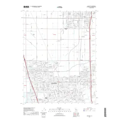
2018 Map of Lodi South
USGS Topo · Published 2018About this map
Stockton and Lodi anchor this 2018 survey of the Northern San Joaquin Valley, a landscape defined by an intricate network of waterways and early 21st-century suburban growth. The northern portion of the city of Stockton is visible, including the Lincoln Village area and educational institutions like Humphreys College - Stockton and Heald College Stockton. This region serves as a critical hydrologic corridor, with the Mokelumne Aqueduct traversing the terrain alongside numerous sloughs, including Pixley Slough, Mosher Slough, and Fourteenmile Slough. The map documents the persistent agricultural and aviation character of the area through features like Kingdon Airpark and Lodi Airpark. Rail lines, specifically the Sacramento Valley and San Joaquin Valley railroads, run parallel to modern transit corridors, connecting smaller settlements like Armstrong, Tomspur, and Monada to the larger urban centers of the valley floor.
Find a feature on this map
75 named features on this map. Tap any name to fly to it.
Don’t see what you’re looking for? This feature index may not catch every label — zoom into the map to look around manually.
Map Details
Editions of this 2018 Lodi South Map
This is the sole edition of this map. No revisions or reprints were ever made.
Other maps of this area

1894 · Lodi
USGS Topo · 1:125,000

1908 · Waterloo
USGS Topo · 1:31,680

1908 · Lockeford
USGS Topo · 1:31,680

1910 · New Hope
USGS Topo · 1:31,680

1910 · Castle
USGS Topo · 1:31,680

1910 · Woodbridge
USGS Topo · 1:31,680

1910 · Headreach
USGS Topo · 1:31,680

1913 · Stockton
USGS Topo · 1:31,680

1913 · Holt
USGS Topo · 1:31,680

1914 · Burnham
USGS Topo · 1:31,680