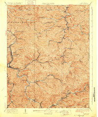
1928 Map of Logan
USGS Topo · Published 1928About this map
Coal-country commerce and winding river transport dominate this 1920s survey of the Guyandotte River valley. The Logan settlement serves as a central hub, flanked by mining and rail points like Aracoma and Rum Junction Kleenkoal PO. This era shows a landscape deeply integrated with the Chesapeake and Ohio railroad, which follows the river's curves to reach remote hollows and industrial outposts.
Find a feature on this map
123 named features on this map. Tap any name to fly to it.
Don’t see what you’re looking for? This feature index may not catch every label — zoom into the map to look around manually.
Map Details
Editions of this 1928 Logan Map
3 editions found
Other maps of this area

1887 · Warfield
USGS Topo · 1:125,000

1891 · Oceana
USGS Topo · 1:125,000

1891 · Warfield
USGS Topo · 1:125,000

1892 · Huntington
USGS Topo · 1:125,000

1893 · Oceana
USGS Topo · 1:125,000

1898 · Huntington
USGS Topo · 1:125,000

1898 · Oceana
USGS Topo · 1:125,000

1899 · Charleston
USGS Topo · 1:125,000

1902 · Midkiff
USGS Topo · 1:62,500

1907 · Midkiff
USGS Topo · 1:62,500