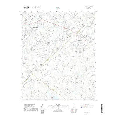
2020 Map of Loganville
USGS Topo · Published 2020About this map
The municipal centers of Loganville and Snellville anchor this 2020 landscape, marking the continuing suburban development where Gwinnett, Walton, and Rockdale counties meet. While residential neighborhoods and major thoroughfares like U S Highway 78 define much of the area, the map still records traces of an earlier rural character through features like McElroys Mill and Indian Shoals. Waterways such as Big Haynes Cr, Brushy Fork, and Little Haynes Cr weave through the terrain, punctuated by numerous named bodies of water including Moons Lake and Henderson Lake. Genealogists and local historians can find specifically recorded sites such as Hillcrest Cem, Old Zion Cemetery, and Plummer Cem, which provide fixed points for tracing family histories within these shifting community boundaries.
Find a feature on this map
39 named features on this map. Tap any name to fly to it.
Don’t see what you’re looking for? This feature index may not catch every label — zoom into the map to look around manually.
Map Details
Editions of this 2020 Loganville Map
This is the sole edition of this map. No revisions or reprints were ever made.
Other maps of this area

1888 · Atlanta
USGS Topo · 1:125,000

1890 · Atlanta
USGS Topo · 1:125,000

1892 · Atlanta
USGS Topo · 1:125,000

1895 · Atlanta
USGS Topo · 1:125,000

1896 · Monroe
USGS Topo · 1:125,000

1953 · Atlanta
USGS Topo · 1:250,000

1953 · Athens
USGS Topo · 1:250,000

1956 · Snellville
USGS Topo · 1:24,000

1956 · Conyers
USGS Topo · 1:24,000

1957 · Atlanta
USGS Topo · 1:250,000