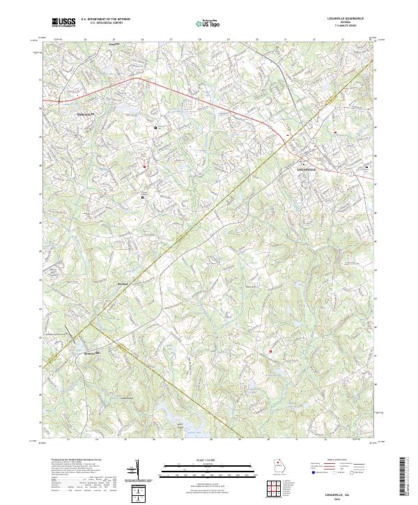
2024 Map of Loganville
USGS Topo · Published 2024About this map
Loganville serves as the focal point for this contemporary survey of the suburban and rural landscapes where Gwinnett, Walton, and Rockdale Counties meet. The terrain is defined by the drainage basins of Big Haynes Creek and Little Haynes Creek, which flow southward toward the distinct water bodies of Hickman Lake and Anderson Lake III. The road network is dominated by the corridor of US Highway 78, connecting the growing residential areas near Grayson and Snellville to the west.
Find a feature on this map
43 named features on this map. Tap any name to fly to it.
Don’t see what you’re looking for? This feature index may not catch every label — zoom into the map to look around manually.
Map Details
Editions of this 2024 Loganville Map
This is the sole edition of this map. No revisions or reprints were ever made.
Other maps of this area

1888 · Atlanta
USGS Topo · 1:125,000

1890 · Atlanta
USGS Topo · 1:125,000

1892 · Atlanta
USGS Topo · 1:125,000

1895 · Atlanta
USGS Topo · 1:125,000

1896 · Monroe
USGS Topo · 1:125,000

1953 · Atlanta
USGS Topo · 1:250,000

1953 · Athens
USGS Topo · 1:250,000

1956 · Snellville
USGS Topo · 1:24,000

1956 · Conyers
USGS Topo · 1:24,000

1957 · Atlanta
USGS Topo · 1:250,000