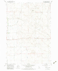
1964 Map of Lone Butte
USGS Topo · Published 1983About this map
Lone Butte rises as the primary landmark in this high-desert landscape of Clark County, Idaho. The terrain is defined by the drainage patterns of Medicine Lodge Creek to the west and the meandering Cottonwood Creek through the center, illustrating the critical role of water in this arid region. This 1964 field-checked survey reveals an area largely dedicated to livestock and dryland farming, where small-scale infrastructure like a Water Tank and Storage Bin supported local operations. The map also records numerous Gravel Pits and Borrow Pits concentrated along the central plains, likely indicating material extraction for the construction of nearby roads and boundary fence lines, which are meticulously noted throughout the quadrangle.
Find a feature on this map
12 named features on this map. Tap any name to fly to it.
Don’t see what you’re looking for? This feature index may not catch every label — zoom into the map to look around manually.
Map Details
Editions of this 1964 Lone Butte Map
2 editions found
Other maps of this area

1955 · Dubois
USGS Topo · 1:250,000

1957 · Paul Reservoir
USGS Topo · 1:62,500

1958 · Dubois
USGS Topo · 1:250,000

1964 · Dubois NW
USGS Topo · 1:24,000

1964 · Lone Butte
USGS Topo · 1:24,000

1964 · Small
USGS Topo · 1:24,000

1964 · Cedar Butte SW
USGS Topo · 1:24,000

1964 · Camas
USGS Topo · 1:24,000

1964 · Cedar Butte SE
USGS Topo · 1:24,000

1972 · Spencer South
USGS Topo · 1:24,000