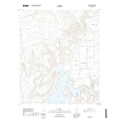
2019 Map of Lone Camp
USGS Topo · Published 2019About this map
Palo Pinto Creek Reservoir and the meandering Brazos River define the local topography of this Palo Pinto County landscape. The settlement of Lone Camp sits at a crossroads east of the rugged drainage basins of Kettle Hollow and Bear Canyon. A network of rural farm-to-market roads, including FM 4 and FM 3137, connects the residential clusters near Village Bend to the surrounding hills. Genealogists and local historians will find the Lake Creek Cem positioned near the banks of Lake Creek, while physical landmarks like Whit Mtn and Ward Mtn provide fixed points across the terrain. The contrast between the flat river bottoms and the deep cuts of Wilson Hollow and Hittson Hollow illustrates the varied character of north-central Texas land use, ranging from cattle ranching at McClure Ranch Rd to lakeside development.
Find a feature on this map
56 named features on this map. Tap any name to fly to it.
Don’t see what you’re looking for? This feature index may not catch every label — zoom into the map to look around manually.
Map Details
Editions of this 2019 Lone Camp Map
This is the sole edition of this map. No revisions or reprints were ever made.
Other maps of this area

1891 · Palo Pinto
USGS Topo · 1:125,000

1918 · Palo Pinto
USGS Topo · 1:125,000

1924 · Palo Pinto 2-c
USGS Topo · 1:48,000

1925 · Palo Pinto 4-b
USGS Topo · 1:48,000

1927 · Pickwick
USGS Topo · 1:62,500

1927 · Mineral Wells
USGS Topo · 1:62,500

1931 · Santo
USGS Topo · 1:62,500

1954 · Abilene
USGS Topo · 1:250,000

1958 · Abilene
USGS Topo · 1:250,000

1958 · Palo Pinto
USGS Topo · 1:62,500