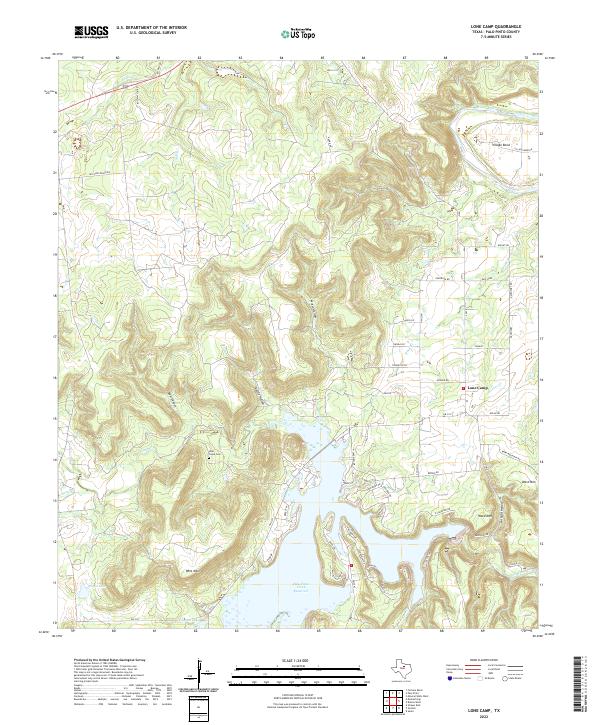
2022 Map of Lone Camp
USGS Topo · Published 2022About this map
Palo Pinto Creek Reservoir serves as a central geographical focal point in this portion of North Texas, where the landscape is defined by the winding course of the Brazos River and the rugged elevation of Whit Mtn and Ward Mtn. The settlement of Lone Camp is situated at the junction of several rural routes including FM 3137 and FM 4, anchoring a community defined by its proximity to both the river and the reservoir. Local history and genealogy are anchored at the Lake Creek Cem, which overlooks the surrounding hills and canyons such as Bear Canyon and Kettle Hollow. The presence of Village Bend along the Brazos suggests a long-standing relationship between the local geography and the river's path, while smaller water bodies like Ringo Lake and Johnson Lake dot the terrain to the southwest, providing a detailed look at the hydrology of the area during the early 2020s.
Find a feature on this map
60 named features on this map. Tap any name to fly to it.
Don’t see what you’re looking for? This feature index may not catch every label — zoom into the map to look around manually.
Map Details
Editions of this 2022 Lone Camp Map
This is the sole edition of this map. No revisions or reprints were ever made.
Other maps of this area

1891 · Palo Pinto
USGS Topo · 1:125,000

1918 · Palo Pinto
USGS Topo · 1:125,000

1924 · Palo Pinto 2-c
USGS Topo · 1:48,000

1925 · Palo Pinto 4-b
USGS Topo · 1:48,000

1927 · Pickwick
USGS Topo · 1:62,500

1927 · Mineral Wells
USGS Topo · 1:62,500

1931 · Santo
USGS Topo · 1:62,500

1954 · Abilene
USGS Topo · 1:250,000

1958 · Abilene
USGS Topo · 1:250,000

1958 · Palo Pinto
USGS Topo · 1:62,500