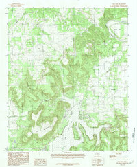
1984 Map of Lone Camp
USGS Topo · Published 1984About this map
Lone Camp serves as a central hub in this Palo Pinto County landscape, situated near the headwaters of several drainage systems. The topography is defined by significant elevations like Whit Mountain and Palo Pinto Mountain, which overlook a network of seasonal and perennial watercourses. The Brazos River makes a sweeping turn at Village Bend in the northeast, while Palo Pinto Creek and Johnson Lake dominate the southern portion of the quadrangle.
Find a feature on this map
19 named features on this map. Tap any name to fly to it.
Don’t see what you’re looking for? This feature index may not catch every label — zoom into the map to look around manually.
Map Details
Editions of this 1984 Lone Camp Map
This is the sole edition of this map. No revisions or reprints were ever made.
Other maps of this area

1891 · Palo Pinto
USGS Topo · 1:125,000

1918 · Palo Pinto
USGS Topo · 1:125,000

1924 · Palo Pinto 2-c
USGS Topo · 1:48,000

1925 · Palo Pinto 4-b
USGS Topo · 1:48,000

1927 · Pickwick
USGS Topo · 1:62,500

1927 · Mineral Wells
USGS Topo · 1:62,500

1931 · Santo
USGS Topo · 1:62,500

1954 · Abilene
USGS Topo · 1:250,000

1958 · Abilene
USGS Topo · 1:250,000

1958 · Palo Pinto
USGS Topo · 1:62,500