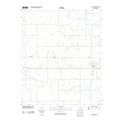
2009 Map of Lone Grove
USGS Topo · Published 2009About this map
Lone Grove serves as the primary hub in this southern Oklahoma landscape, where the town's expansion is documented alongside a complex network of rural arteries and waterways. The western edge of the quadrangle is anchored by the Keller Cemetery, a significant point of interest for genealogists tracing early families in the region. The drainage patterns are defined by several notable water bodies, including Cottonwood Creek, Walnut Creek, and Sullivan Creek, which carve through the terrain and dictate the placement of local infrastructure.
Find a feature on this map
47 named features on this map. Tap any name to fly to it.
Don’t see what you’re looking for? This feature index may not catch every label — zoom into the map to look around manually.
Map Details
Editions of this 2009 Lone Grove Map
This is the sole edition of this map. No revisions or reprints were ever made.
Other maps of this area

1901 · Ardmore
USGS Topo · 1:125,000

1918 · Ardmore
USGS Topo · 1:125,000

1957 · Ardmore
USGS Topo · 1:250,000

1963 · Ardmore
USGS Topo · 1:250,000

1964 · Ardmore West
USGS Topo · 1:24,000

1964 · Overbrook
USGS Topo · 1:24,000

1964 · Springer
USGS Topo · 1:24,000

1969 · Healdton
USGS Topo · 1:24,000

1969 · Lone Grove
USGS Topo · 1:24,000
1969 · Healdton SW
USGS Topo · 1:24,000