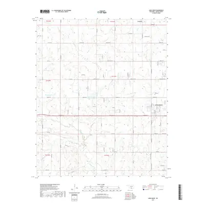
2018 Map of Lone Grove
USGS Topo · Published 2018About this map
The settlement of Lone Grove serves as the primary hub in this Carter County landscape, centered along a grid of residential and local connector roads. The geography is defined by a dense network of tributaries including Cottonwood Creek and Walnut Bayou, with the Upper Bayou Site 6 Reservoir providing significant water management in the western sections. To the north, the small community of Newport sits near the edge of the survey area, while family-named roads like Keller Road and Rounsaville Avenue reflect the region's agricultural and local history. Genealogists may find value in the locations of Lone Grove Cemetery and Keller Cemetery, which are preserved alongside rural landmarks like Demijohn Creek and Bull Creek.
Find a feature on this map
86 named features on this map. Tap any name to fly to it.
Don’t see what you’re looking for? This feature index may not catch every label — zoom into the map to look around manually.
Map Details
Editions of this 2018 Lone Grove Map
This is the sole edition of this map. No revisions or reprints were ever made.
Other maps of this area

1901 · Ardmore
USGS Topo · 1:125,000

1918 · Ardmore
USGS Topo · 1:125,000

1957 · Ardmore
USGS Topo · 1:250,000

1963 · Ardmore
USGS Topo · 1:250,000

1964 · Ardmore West
USGS Topo · 1:24,000

1964 · Overbrook
USGS Topo · 1:24,000

1964 · Springer
USGS Topo · 1:24,000

1969 · Healdton
USGS Topo · 1:24,000

1969 · Lone Grove
USGS Topo · 1:24,000
1969 · Healdton SW
USGS Topo · 1:24,000