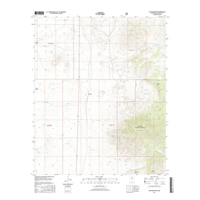
2017 Map of Lone Mountain
USGS Topo · Published 2017About this map
Coyote sits at the base of the high desert terrain that characterizes this portion of Lincoln County, defined by its critical reliance on water management in an arid landscape. The area is dotted with numerous tanks and springs necessary for ranching and survival, such as Bond Spring Tank, Collier Spring, and the Post Corral Tank. The southern portion of the sheet is dominated by the northern reaches of the Lincoln National Forest, where the topography rises sharply toward Lone Mountain and Baxter Mtn. Traces of earlier industrial activity are evident near the forest boundary, including a Tunnel and the Iron Mine Tank. This network of earthen tanks, from Red Lake in the northwest to Murphy Tank in the northeast, illustrates the complex land use and water rights of the high New Mexico plains.
Find a feature on this map
46 named features on this map. Tap any name to fly to it.
Don’t see what you’re looking for? This feature index may not catch every label — zoom into the map to look around manually.
Map Details
Editions of this 2017 Lone Mountain Map
This is the sole edition of this map. No revisions or reprints were ever made.
Other maps of this area

1934 · Capitan
USGS Topo · 1:48,000

1937 · Capitan
USGS Topo · 1:62,500

1938 · Carrizozo
USGS Topo · 1:48,000

1943 · Carrizozo
USGS Topo · 1:62,500

1950 · Carrizozo
USGS Topo · 1:62,500

1950 · Little Black Peak
USGS Topo · 1:62,500

1955 · Roswell
USGS Topo · 1:250,000

1958 · Roswell
USGS Topo · 1:250,000

1962 · Roswell
USGS Topo · 1:250,000

1973 · Ancho
USGS Topo · 1:24,000