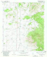
1982 Map of Lone Mountain
USGS Topo · Published 1982About this map
Lone Mountain dominates the eastern half of this Lincoln County landscape, surrounded by the high-elevation terrain of the Lincoln National Forest. The map documents a landscape defined by water scarcity and ranching infrastructure, where the Southern Pacific tracks bisect the western plains. Life in this arid environment is evidenced by dozens of water management features, from the Dunning Ranch to family-named landmarks like Harkey Tank and Collier Spring.
Find a feature on this map
49 named features on this map. Tap any name to fly to it.
Don’t see what you’re looking for? This feature index may not catch every label — zoom into the map to look around manually.
Map Details
Editions of this 1982 Lone Mountain Map
This is the sole edition of this map. No revisions or reprints were ever made.
Other maps of this area

1934 · Capitan
USGS Topo · 1:48,000

1937 · Capitan
USGS Topo · 1:62,500

1938 · Carrizozo
USGS Topo · 1:48,000

1943 · Carrizozo
USGS Topo · 1:62,500

1950 · Carrizozo
USGS Topo · 1:62,500

1950 · Little Black Peak
USGS Topo · 1:62,500

1955 · Roswell
USGS Topo · 1:250,000

1958 · Roswell
USGS Topo · 1:250,000

1962 · Roswell
USGS Topo · 1:250,000

1973 · Ancho
USGS Topo · 1:24,000