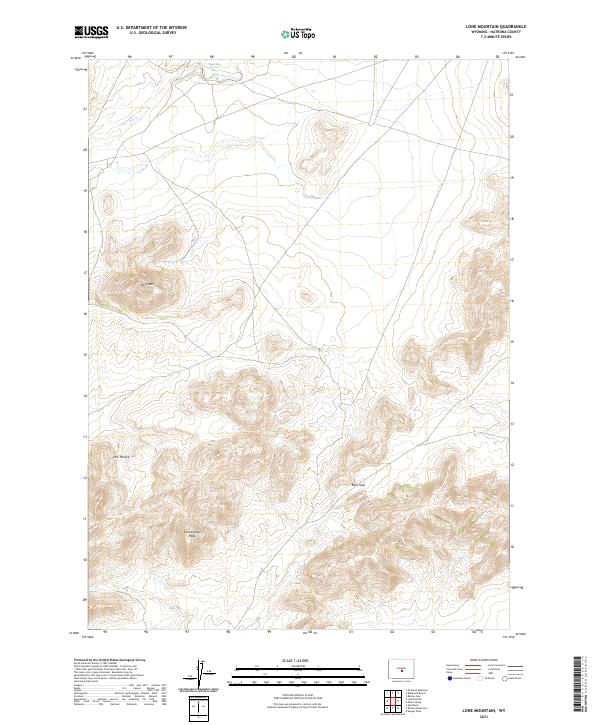
2021 Map of Lone Mountain
USGS Topo · Published 2021About this map
Lone Mtn dominates this high-altitude landscape in central Wyoming, serving as a prominent landmark for surveyors and travelers alike. The terrain is defined by its dramatic elevation changes, characterized by natural basins and high points such as Vice Pocket and Countryman Peak. In this arid environment, water sources like Sage Hen Springs are critical features, feeding the intermittent flow of Sage Hen Creek as it winds through the northern sections of the quadrangle. The map details the Public Land Survey System grid across multiple townships, illustrating the vast, open land management patterns of Natrona County. A narrow passage known as Beef Gap provides a logical crossing point through the ridgelines, suggesting historical movement of livestock or early travelers through this section of the range.
Find a feature on this map
13 named features on this map. Tap any name to fly to it.
Don’t see what you’re looking for? This feature index may not catch every label — zoom into the map to look around manually.
Map Details
Editions of this 2021 Lone Mountain Map
This is the sole edition of this map. No revisions or reprints were ever made.
Other maps of this area

1951 · Savage Peak
USGS Topo · 1:24,000

1951 · Bucklin Reservoirs
USGS Topo · 1:24,000

1951 · Lone Mountain
USGS Topo · 1:24,000

1951 · Split Rock
USGS Topo · 1:24,000

1951 · Lankin Dome
USGS Topo · 1:24,000

1952 · Mc Intosh Meadows
USGS Topo · 1:24,000

1955 · Casper
USGS Topo · 1:250,000

1958 · Casper
USGS Topo · 1:250,000

1959 · Miller Spring
USGS Topo · 1:24,000

1959 · Blackjack Ranch
USGS Topo · 1:24,000