
1951 Map of Split Rock
USGS Topo · Published 1953About this map
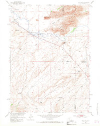
Sweetwater River irrigation and high-desert ranching define this central Wyoming landscape during the early 1950s. The map illustrates a network of water management essential for livestock, featuring the Mc Intosh Ditch and Cranner Ditch which divert water to family-run operations like the Mc Intosh Ranch and Split Rock Ranch. Settlement patterns here are tied closely to these water sources and the sheltering terrain of Beaton Pocket, while the presence of the CCC Camp (Aban'd) and Grieves Homestead (Aban'd) suggests the shifting nature of land use in the mid-20th century.
Find a feature on this map
33 named features on this map. Tap any name to fly to it.
Don’t see what you’re looking for? This feature index may not catch every label — zoom into the map to look around manually.
Map Details
Editions of this 1951 Split Rock Map
4 editions found
Other maps of this area

1951 · Bucklin Reservoirs
USGS Topo · 1:24,000

1951 · Lone Mountain
USGS Topo · 1:24,000

1951 · Black Rock Gap
USGS Topo · 1:24,000

1951 · Split Rock NW
USGS Topo · 1:24,000

1951 · Lankin Dome
USGS Topo · 1:24,000

1955 · Casper
USGS Topo · 1:250,000

1958 · Casper
USGS Topo · 1:250,000

1962 · Casper
USGS Topo · 1:250,000

1962 · Whiskey Peak
USGS Topo · 1:24,000
1962 · Sagebrush Park
USGS Topo · 1:24,000