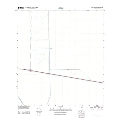
2012 Map of Lone Palm Head
USGS Topo · Published 2012About this map
Big Cypress National Preserve occupies the southwestern portion of this landscape, defining a region where water management and conservation efforts converge. The terrain is characterized by a network of drainage features and human-engineered boundaries, most notably Levee 60 and the Interceptor Canal, which channel the flow across the low-lying interior. Central to this area is Lone Palm Head, a distinct terrain feature that stands as a landmark amidst the wetlands. Transport through this environment is facilitated by major corridors, including the path of Highway 84 and the north-south transit of Lemon Grove Rd. This 2012 survey illustrates the modern hydrological infrastructure required to maintain the balance between the preserve and the surrounding Broward County region.
Find a feature on this map
7 named features on this map. Tap any name to fly to it.
Don’t see what you’re looking for? This feature index may not catch every label — zoom into the map to look around manually.
Map Details
Editions of this 2012 Lone Palm Head Map
This is the sole edition of this map. No revisions or reprints were ever made.
Other maps of this area

1956 · West Palm Beach
USGS Topo · 1:250,000

1957 · West Palm Beach
USGS Topo · 1:250,000

1958 · West Palm Beach
USGS Topo · 1:250,000

1973 · Everglades 4 NW
USGS Topo · 1:24,000

1973 · Everglades 4 SW
USGS Topo · 1:24,000

1973 · Everglades 3 NE
USGS Topo · 1:24,000

1974 · Everglades 1 SW
USGS Topo · 1:24,000

1974 · Everglades 2 SW
USGS Topo · 1:24,000

1974 · Everglades 2 SE
USGS Topo · 1:24,000
1974 · Everglades 3 SW
USGS Topo · 1:24,000