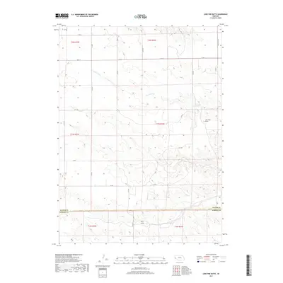
2017 Map of Lone Pine Butte
USGS Topo · Published 2017About this map
Lawrence Fork meanders through this high plains landscape of western Nebraska, where the terrain is defined by dramatic breaks and draws. The prominent landmark of Lone Pine Butte rises above the surrounding plateau in the northeastern section of the map, situated near the seasonal waters of Lone Pine Springs. This area, split between Banner Co and Kimball Co, illustrates the characteristic rural survey patterns of the region, where a sparse network of section-line roads like Co RD 14 and Co RD 49 connect isolated ranching and agricultural operations. To the south, the deep incision of Rocky Hollow reveals the erosional forces that have shaped this portion of the Nebraska Panhandle, creating a landscape where topography dictates the path of local travel and land use.
Find a feature on this map
22 named features on this map. Tap any name to fly to it.
Don’t see what you’re looking for? This feature index may not catch every label — zoom into the map to look around manually.
Map Details
Editions of this 2017 Lone Pine Butte Map
This is the sole edition of this map. No revisions or reprints were ever made.
Other maps of this area

1898 · Scotts Bluff
USGS Topo · 1:125,000

1898 · Camp Clarke
USGS Topo · 1:125,000

1954 · Scottsbluff
USGS Topo · 1:250,000

1958 · Scottsbluff
USGS Topo · 1:250,000

1973 · Potter 2 SW
USGS Topo · 1:24,000

1973 · Scotts Bluff 4 SE
USGS Topo · 1:24,000

1973 · Kimball 1 SE
USGS Topo · 1:24,000

1973 · Scotts Bluff 4 SW
USGS Topo · 1:24,000

1973 · Kimball 1 NE
USGS Topo · 1:24,000

1973 · Kimball 1 NW
USGS Topo · 1:24,000