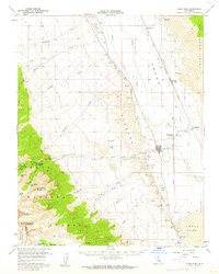
1958 Map of Lone Pine
USGS Topo · Published 1962About this map
The town of Lone Pine serves as the focal point of this 1958 survey, situated at the base of the eastern Sierra Nevada. The landscape is dominated by the transition from high-altitude peaks like Mt Whitney and Lone Pine Peak down into the arid Owens Valley. Historical infrastructure is well-documented, showing the Los Angeles Aqueduct paralleling the Owens River, alongside numerous irrigation features such as the Eclipse Ditch and MC Iver Ditch. The cultural footprint of the mid-20th century is evident in the presence of Manzanar, the site of a wartime relocation center, and Movie Flat within the Alabama Hills, a well-known filming location for Western cinema.
Find a feature on this map
46 named features on this map. Tap any name to fly to it.
Don’t see what you’re looking for? This feature index may not catch every label — zoom into the map to look around manually.
Map Details
Editions of this 1958 Lone Pine Map
4 editions found
Other maps of this area

1905 · Olancha
USGS Topo · 1:125,000

1907 · Olancha
USGS Topo · 1:125,000

1907 · Mt. Whitney
USGS Topo · 1:125,000

1908 · Ballarat
USGS Topo · 1:250,000

1913 · Ballarat
USGS Topo · 1:250,000

1919 · Mt. Whitney
USGS Topo · 1:125,000

1937 · Mt. Whitney
USGS Topo · 1:125,000

1948 · Death Valley
USGS Topo · 1:250,000

1948 · Fresno
USGS Topo · 1:250,000

1950 · New York Butte
USGS Topo · 1:62,500