
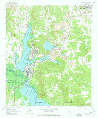
1962 Map of Lone Star
USGS Topo · Published 1964About this map
Industrial and hydrological development in East Texas define this landscape during the early 1960s. The massive Steel Plant dominates the area south of Lone Star, supported by a complex network of water resources including the Ellison Creek Reservoir and the Barnes Creek Reservoir. The presence of a Tailings Pond and several Strip Mines indicate the heavy extractive activity of the era, while the Texas and Northern railroad provides the vital link for industrial transport.
Find a feature on this map
50 named features on this map. Tap any name to fly to it.
Don’t see what you’re looking for? This feature index may not catch every label — zoom into the map to look around manually.
Map Details
Editions of this 1962 Lone Star Map
2 editions found
Other maps of this area

1914 · Daingerfield
USGS Topo · 1:62,500

1953 · Texarkana
USGS Topo · 1:250,000

1956 · Texarkana
USGS Topo · 1:250,000

1956 · Tyler
USGS Topo · 1:250,000

1960 · Coffeeville
USGS Topo · 1:24,000

1960 · La Fayette
USGS Topo · 1:24,000

1961 · Lassater
USGS Topo · 1:24,000

1962 · Avinger
USGS Topo · 1:24,000

1962 · Ore City
USGS Topo · 1:24,000

1964 · Daingerfield
USGS Topo · 1:24,000