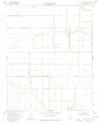
1954 Map of Lone Tree Well
USGS Topo · Published 1978About this map
The Sand Ridge provides a distinct topographic break across the Tulare Lake Basin in this mid-century look at the agricultural plumbing of the San Joaquin Valley. At a time when the region was heavily engineered for water management, the landscape is defined by an extensive system of water control features, including the Hacienda Spillway and the Kern River Channel. The presence of several Levee systems and an Abandoned Canal indicates a shifting strategy in irrigation and flood control during the 1950s. Near the border of Kings Co Kern Co, the map documents localized landmarks like Lone Tree Well and the Burhans Ranch. These small nodes of human activity were essential outposts for ranching and water maintenance in a territory largely defined by straight-line section boundaries and artificial waterways like the Homeland Canal.
Find a feature on this map
14 named features on this map. Tap any name to fly to it.
Don’t see what you’re looking for? This feature index may not catch every label — zoom into the map to look around manually.
Map Details
Editions of this 1954 Lone Tree Well Map
2 editions found
Other maps of this area

1914 · Lost Hills
USGS Topo · 1:125,000

1929 · Hacienda Ranch
USGS Topo · 1:31,680

1929 · West Alpaugh
USGS Topo · 1:31,680

1930 · Miramonte Ranch
USGS Topo · 1:31,680

1931 · Harvester
USGS Topo · 1:31,680

1932 · Dudley Ridge
USGS Topo · 1:31,680

1932 · Antelope Plain
USGS Topo · 1:31,680

1932 · Reynolds Ranch
USGS Topo · 1:31,680

1932 · West Camp
USGS Topo · 1:31,680

1932 · Lone Tree Well
USGS Topo · 1:31,680