
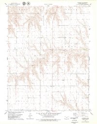
1978 Map of Long Draw South
USGS Topo · Published 1979About this map
The high plains of Northwest Kansas are defined here by the intricate drainage of the South Fork Sappa Creek and the Middle Fk Sappa Cr. This 1970s landscape across the border of Rawlins and Thomas counties shows the sparse settlement patterns typical of the region, anchored by the small community of Clinton. The land is divided into large agricultural blocks including Clinton, Jefferson, Wendell, and Rovohl. A glimpse into the area's local history is found in the scattered rural burial grounds like Lone Star Cem, St Patrick Cem, and Cumberland Cem. The terrain is marked by the eponymous Long Draw, which carves through the northern half of the survey, and occasional industrial features such as Sandpit and several wells that indicate the local reliance on groundwater and earth resources.
Find a feature on this map
14 named features on this map. Tap any name to fly to it.
Don’t see what you’re looking for? This feature index may not catch every label — zoom into the map to look around manually.
Map Details
Editions of this 1978 Long Draw South Map
This is the sole edition of this map. No revisions or reprints were ever made.
Other maps of this area

1943 · Colby
USGS Topo · 1:62,500

1951 · Achilles
USGS Topo · 1:62,500

1951 · Chardon
USGS Topo · 1:62,500

1954 · Goodland
USGS Topo · 1:250,000

1956 · Goodland
USGS Topo · 1:250,000

1957 · Goodland
USGS Topo · 1:250,000

1965 · Achilles
USGS Topo · 1:24,000

1967 · Colby
USGS Topo · 1:24,000

1978 · Achilles SE
USGS Topo · 1:24,000
1978 · Chardon
USGS Topo · 1:24,000