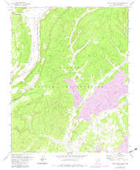
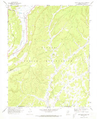
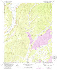
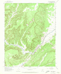
1971 Map of Long House Valley
USGS Topo · Published 1983About this map
Long House Valley serves as a primary corridor for transportation and resource extraction within the Navajo Indian Reservation. This map reveals a complex industrial footprint established by the early 1970s, dominated by extensive Mine Strip operations and a significant Conveyor Belt system that cuts across the high terrain. The land use here is a striking mix of the ancient and the modern; the Long House Ruin stands in House Canyon near the northern edge, while a Landing Strip and Radio Towers serve the industrial needs of the coal operations to the south. Moving through the drainage of Yellow Water Canyon, the landscape is marked by Coal Wells and various prospects, illustrating the intensive mineral exploration that defined this era in Northern Arizona. A network of Jeep Trails and a Pack Trail provide the only access into the remote reaches of Wild Ram Valley.
Find a feature on this map
23 named features on this map. Tap any name to fly to it.
Don’t see what you’re looking for? This feature index may not catch every label — zoom into the map to look around manually.
Map Details
Editions of this 1971 Long House Valley Map
3 editions found
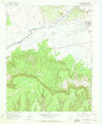
Other maps of this area

1883 · Marsh Pass
USGS Topo · 1:250,000

1892 · Marsh Pass
USGS Topo · 1:250,000

1956 · Marble Canyon
USGS Topo · 1:250,000

1959 · Marble Canyon
USGS Topo · 1:250,000

1961 · Marble Canyon
USGS Topo · 1:250,000
1968 · Kayenta West
USGS Topo · 1:24,000
1968 · Marsh Pass
USGS Topo · 1:24,000
1968 · Yucca Hill
USGS Topo · 1:24,000
1968 · Marsh Pass SE
USGS Topo · 1:24,000
1970 · Shonto SE
USGS Topo · 1:24,000