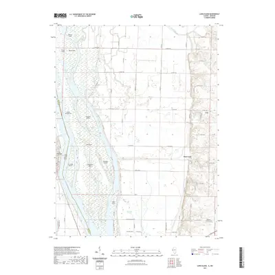
2021 Map of Long Island
USGS Topo · Published 2021About this map
The Mississippi River defines the complex hydrography of this borderland, where the Missouri-Illinois state line weaves through a vast archipelago of river islands and side channels. Long Island dominates the center of the waterway, flanked by Smoots Chute and Canton Chute. This riverine environment is punctuated by inland water bodies like Indian Grave Lake and Long Island Lake, reflecting a landscape shaped by seasonal flooding and shifting currents.
Find a feature on this map
68 named features on this map. Tap any name to fly to it.
Don’t see what you’re looking for? This feature index may not catch every label — zoom into the map to look around manually.
Map Details
Editions of this 2021 Long Island Map
This is the sole edition of this map. No revisions or reprints were ever made.
Other maps of this area

1903 · Kahoka
USGS Topo · 1:125,000

1903 · Palmyra
USGS Topo · 1:125,000

1925 · Quincy
USGS Topo · 1:62,500

1944 · Quincy
USGS Topo · 1:62,500

1945 · Quincy
USGS Topo · 1:62,500

1946 · Mendon
USGS Topo · 1:62,500

1948 · Quincy
USGS Topo · 1:250,000

1948 · Mendon
USGS Topo · 1:62,500

1949 · Maywood
USGS Topo · 1:24,000
1950 · Maywood
USGS Topo · 1:24,000