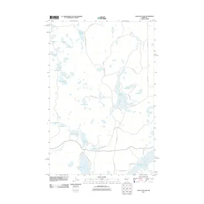
2011 Map of Long Lost Lake
USGS Topo · Published 2011About this map
Glacial lakes and dense woodland roads dominate this portion of Becker County, where the landscape is defined by a high density of water bodies ranging from the expansive Long Lost Lake to smaller basins like Hoot Owl Lake and West Cranberry Lake. The road network is primarily composed of winding rural routes and fireways, such as Big Hill Fireway and Waptus McKenzie Lake Rd, suggesting a region dedicated to timber management and seasonal recreation. The proximity of Juggler Lake and Bad Medicine Lake in the southern portion of the quadrangle highlights the area's intricate hydrology, with Bear Creek providing a primary drainage course through the timberland. This 2011 survey captures the area before significant modern development, showing the established access points like Peninsula Rd and Anchor Hill Rd that serve the remote lakefronts.
Find a feature on this map
40 named features on this map. Tap any name to fly to it.
Don’t see what you’re looking for? This feature index may not catch every label — zoom into the map to look around manually.
Map Details
Editions of this 2011 Long Lost Lake Map
This is the sole edition of this map. No revisions or reprints were ever made.
Other maps of this area

1954 · Bemidji
USGS Topo · 1:250,000

1957 · Bemidji
USGS Topo · 1:250,000

1958 · Bemidji
USGS Topo · 1:250,000

1969 · Many Point Lake
USGS Topo · 1:24,000

1969 · Roy Lake
USGS Topo · 1:24,000

1969 · Tulaby Lake
USGS Topo · 1:24,000

1969 · Anchor Hill
USGS Topo · 1:24,000

1969 · Big Basswood Lake
USGS Topo · 1:24,000
1969 · Big Rush Lake
USGS Topo · 1:24,000

1969 · Long Lost Lake
USGS Topo · 1:24,000