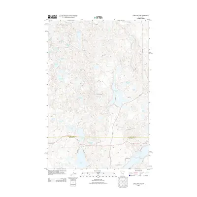
2013 Map of Long Lost Lake
USGS Topo · Published 2013About this map
Long Lost Lake sits at the heart of this post-millennium landscape, marking the transition between Clearwater and Becker counties. The area is defined by a dense concentration of glacial basins, ranging from the expansive waters of Bad Medicine Lake and Juggler Lake in the south to smaller, secluded bodies like Hoot Owl Lake and Siren Lake. The road network, including MN-113 and Co Hwy 39, provides access to these timbered highlands, where landmarks such as Anchor Hill rise above the complex shoreline of Glanders Lake. This map captures a modern view of a region long valued for its recreational and natural resources, documenting the residential developments along Peninsula Rd and the access routes like W Juggler Rd that serve the various lakeside properties.
Find a feature on this map
40 named features on this map. Tap any name to fly to it.
Don’t see what you’re looking for? This feature index may not catch every label — zoom into the map to look around manually.
Map Details
Editions of this 2013 Long Lost Lake Map
This is the sole edition of this map. No revisions or reprints were ever made.
Other maps of this area

1954 · Bemidji
USGS Topo · 1:250,000

1957 · Bemidji
USGS Topo · 1:250,000

1958 · Bemidji
USGS Topo · 1:250,000

1969 · Many Point Lake
USGS Topo · 1:24,000

1969 · Roy Lake
USGS Topo · 1:24,000

1969 · Tulaby Lake
USGS Topo · 1:24,000

1969 · Anchor Hill
USGS Topo · 1:24,000

1969 · Big Basswood Lake
USGS Topo · 1:24,000
1969 · Big Rush Lake
USGS Topo · 1:24,000

1969 · Long Lost Lake
USGS Topo · 1:24,000