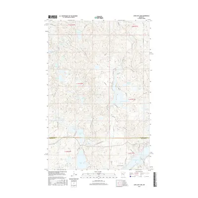
2016 Map of Long Lost Lake
USGS Topo · Published 2016About this map
Long Lost Lake and its surrounding dense network of glacial basins define this landscape along the boundary of Clearwater and Becker Counties. This mid-2010s survey shows a region largely preserved for recreation and conservation, centered on the N Country National Scenic Trail as it winds through the central corridor. The map reveals the intricate shoreline of Bad Medicine Lake in the southeast and the remote character of waters like McKenzie Lake and Juggler Lake. A complex system of forest roads and trails, including McKenzie Rd and Big Hill Fireway, provides the primary access to the numerous small lakes such as Siren Lake and Cesar Lake. The presence of established recreation points like Black Bear Beach Rd indicates the area's continued importance for seasonal residency and outdoor heritage in the Minnesota northwoods.
Find a feature on this map
61 named features on this map. Tap any name to fly to it.
Don’t see what you’re looking for? This feature index may not catch every label — zoom into the map to look around manually.
Map Details
Editions of this 2016 Long Lost Lake Map
This is the sole edition of this map. No revisions or reprints were ever made.
Other maps of this area

1954 · Bemidji
USGS Topo · 1:250,000

1957 · Bemidji
USGS Topo · 1:250,000

1958 · Bemidji
USGS Topo · 1:250,000

1969 · Many Point Lake
USGS Topo · 1:24,000

1969 · Roy Lake
USGS Topo · 1:24,000

1969 · Tulaby Lake
USGS Topo · 1:24,000

1969 · Anchor Hill
USGS Topo · 1:24,000

1969 · Big Basswood Lake
USGS Topo · 1:24,000
1969 · Big Rush Lake
USGS Topo · 1:24,000

1969 · Long Lost Lake
USGS Topo · 1:24,000