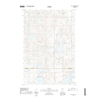
2019 Map of Long Lost Lake
USGS Topo · Published 2019About this map
Long Lost Lake and a dense network of glacial water bodies dominate this landscape along the border of Becker and Clearwater counties. The terrain is defined by its complex hydrography, featuring irregular shorelines and isolated islands like Pine Island within Pine Island Lake. A web of local roads and trails, including the N Country National Scenic Trail, navigates the many lakes and depressions, reflecting the area's development for recreation and seasonal residence.
Find a feature on this map
60 named features on this map. Tap any name to fly to it.
Don’t see what you’re looking for? This feature index may not catch every label — zoom into the map to look around manually.
Map Details
Editions of this 2019 Long Lost Lake Map
This is the sole edition of this map. No revisions or reprints were ever made.
Other maps of this area

1954 · Bemidji
USGS Topo · 1:250,000

1957 · Bemidji
USGS Topo · 1:250,000

1958 · Bemidji
USGS Topo · 1:250,000

1969 · Many Point Lake
USGS Topo · 1:24,000

1969 · Roy Lake
USGS Topo · 1:24,000

1969 · Tulaby Lake
USGS Topo · 1:24,000

1969 · Anchor Hill
USGS Topo · 1:24,000

1969 · Big Basswood Lake
USGS Topo · 1:24,000
1969 · Big Rush Lake
USGS Topo · 1:24,000

1969 · Long Lost Lake
USGS Topo · 1:24,000