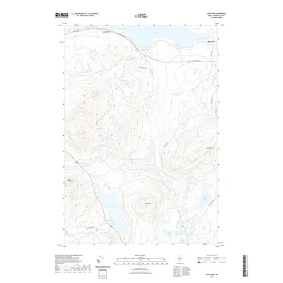
2021 Map of Long Pond
USGS Topo · Published 2021About this map
Parlin Pond and the surrounding high ground of Somerset County define this wilderness landscape, where the waters of Parlin Stream descend from the slopes of Parlin Mtn. The settlement of Mackamp sits near the confluence of the Moose River and Long Pond, serving as a rare point of habitation in a region dominated by timberland and glacial water bodies. The terrain is marked by significant elevations like Williams Mtn and Bean Brook Mtn, which overlook a network of smaller ponds including Fogg Pond, Fernald Pond, and Smith Pond. A system of logging and access roads, such as Long Pond Rd and Hardscrabble Rd, provides the primary infrastructure through the heavy forest. This survey documents the drainage patterns of Trout Brook and Lang Stream, illustrating the intricate natural hydrology that has historically supported the region's sporting and forestry traditions.
Find a feature on this map
34 named features on this map. Tap any name to fly to it.
Don’t see what you’re looking for? This feature index may not catch every label — zoom into the map to look around manually.
Map Details
Editions of this 2021 Long Pond Map
This is the sole edition of this map. No revisions or reprints were ever made.
Other maps of this area

1905 · The Forks
USGS Topo · 1:62,500

1907 · The Forks
USGS Topo · 1:62,500

1921 · Brassua Lake
USGS Topo · 1:62,500

1922 · Long Pond
USGS Topo · 1:62,500

1923 · Brassua Lake
USGS Topo · 1:62,500

1924 · Long Pond
USGS Topo · 1:62,500

1925 · Pierce Pond
USGS Topo · 1:48,000

1927 · Pierce Pond
USGS Topo · 1:62,500

1944 · Brassua Lake
USGS Topo · 1:62,500

1944 · Long Pond
USGS Topo · 1:62,500
Featured Places
- Jackman, ME
- Misery Gore, ME
- Parlin Pond Township, ME
- Johnson Mountain Township, ME
- Long Pond Township, ME