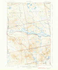
1924 Map of Long Pond
USGS Topo · Published 1944About this map
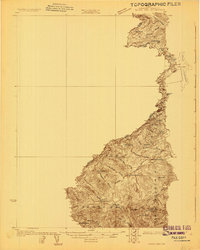
The Canadian Pacific railroad cuts through the heart of the Somerset County wilderness, connecting remote outposts like Jackman Station and Mackamp during the early twentieth century. This survey reveals a landscape shaped by timber and early outdoor recreation, where numerous sporting camps such as Heald Pond Camps, Churchill Camp, and Hichey Camp are positioned along the waterways. The presence of the Jackman Mill and family-named clearings like Whipple Farm and Fogg Farm indicate a localized economy of subsistence and logging. The corridor of U.S. Route 201 winds southward toward Parlin, passing near the Jackman Field landing strip. The terrain is dominated by significant peaks including Bald Mountain and Bean Brook Mtn, with the Moose River and Long Pond serving as the primary drainage and transportation routes for the region.
Find a feature on this map
74 named features on this map. Tap any name to fly to it.
Don’t see what you’re looking for? This feature index may not catch every label — zoom into the map to look around manually.
Map Details
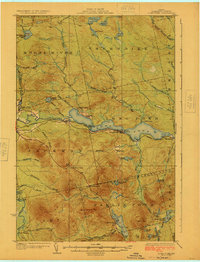
Editions of this 1924 Long Pond Map
5 editions found
Other maps of this area

1905 · The Forks
USGS Topo · 1:62,500

1907 · The Forks
USGS Topo · 1:62,500

1921 · Brassua Lake
USGS Topo · 1:62,500

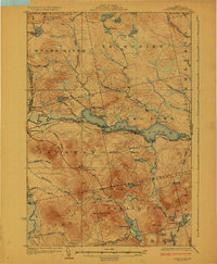
1922 · Long Pond
USGS Topo · 1:62,500

1923 · Brassua Lake
USGS Topo · 1:62,500

1923 · Attean
USGS Topo · 1:62,500

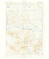
1924 · Long Pond
USGS Topo · 1:62,500

1925 · Pierce Pond
USGS Topo · 1:48,000

1925 · Attean
USGS Topo · 1:62,500
1927 · Sandy Bay
USGS Topo · 1:48,000