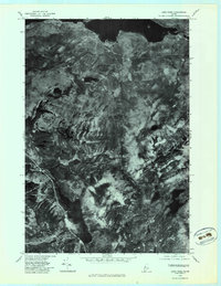
1979 Map of Long Pond
USGS Topo · Published 1983About this map
Lake Parlin and the surrounding wilderness of Somerset County are captured in this 1979 orthophotoquad, showing the dense forest cover and hydrologic network of north-central Maine. The imagery highlights the relationship between prominent peaks like Parlin Mountain and the water bodies that define the local geography, including Long Pond and Parlin Pond. Unlike a traditional topographic map, this aerial perspective reveals the raw texture of the timberlands and the winding path of Parlin Stream. The small settlement of Mackamp sits along the northern shore, providing a rare point of human habitation in a landscape otherwise dominated by natural features like Cold Stream Pond. This format is particularly useful for observing the exact extent of forest roads and shoreline detail as they existed in the late 1970s.
Find a feature on this map
10 named features on this map. Tap any name to fly to it.
Don’t see what you’re looking for? This feature index may not catch every label — zoom into the map to look around manually.
Map Details
Editions of this 1979 Long Pond Map
This is the sole edition of this map. No revisions or reprints were ever made.
Other maps of this area

1905 · The Forks
USGS Topo · 1:62,500

1907 · The Forks
USGS Topo · 1:62,500

1921 · Brassua Lake
USGS Topo · 1:62,500

1922 · Long Pond
USGS Topo · 1:62,500

1923 · Brassua Lake
USGS Topo · 1:62,500

1924 · Long Pond
USGS Topo · 1:62,500

1925 · Pierce Pond
USGS Topo · 1:48,000

1927 · Pierce Pond
USGS Topo · 1:62,500

1944 · Brassua Lake
USGS Topo · 1:62,500

1944 · Long Pond
USGS Topo · 1:62,500
Featured Places
- Jackman, ME
- Misery Gore, ME
- Sandwich Academy Grant Township, ME
- Johnson Mountain Township, ME
- Long Pond Township, ME