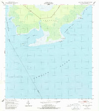
1951 Map of Long Shoal Point
USGS Topo · Published 1987About this map
Pamlico Sound dominates this mid-century coastal survey, illustrating the intricate marshland and water systems at the border of Dare and Hyde Counties. The landscape is defined by its coastal points and secluded bays, including Pains Bay and Parched Corn Bay. A lone Lookout Tower stands near the northern edge, a vital landmark in an area characterized more by water than solid ground. Small islands and navigational aids like Rawls Island and various lights assist in traversing the Long Shoal River. The inclusion of historical hydrography from the late 19th century alongside 1940s aerial photography provides a layered perspective on the shifting shorelines of Pains Point and Long Shoal Point, highlighting the transient nature of the North Carolina coast before significant modern development.
Find a feature on this map
20 named features on this map. Tap any name to fly to it.
Don’t see what you’re looking for? This feature index may not catch every label — zoom into the map to look around manually.
Map Details
Editions of this 1951 Long Shoal Point Map
2 editions found
Other maps of this area

1943 · Roanoke Island
USGS Topo · 1:125,000

1951 · Middletown Anchorage
USGS Topo · 1:24,000

1951 · Long Shoal Point
USGS Topo · 1:24,000

1951 · Engelhard East
USGS Topo · 1:24,000

1953 · Engelhard NW
USGS Topo · 1:24,000

1953 · Stumpy Point
USGS Topo · 1:24,000

1953 · Engelhard NE
USGS Topo · 1:24,000

1955 · Wanchese
USGS Topo · 1:250,000

1957 · Manteo
USGS Topo · 1:250,000

1960 · Manteo
USGS Topo · 1:250,000