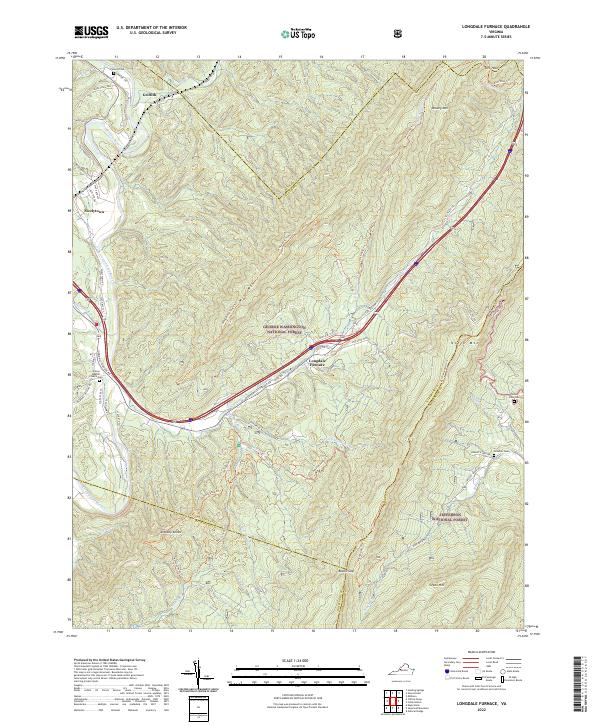
2022 Map of Longdale Furnace
USGS Topo · Published 2022About this map
Longdale Furnace serves as a central landmark in this mountain landscape where the George Washington National Forest and Jefferson National Forest meet. The settlement patterns follow the winding course of the Cowpasture River and its tributaries, such as Simpson Cr and Sharvers Run. This 2022 survey documents a region defined by historical rural infrastructure and small communities like Griffith and Nicelytown.
Find a feature on this map
69 named features on this map. Tap any name to fly to it.
Don’t see what you’re looking for? This feature index may not catch every label — zoom into the map to look around manually.
Map Details
Editions of this 2022 Longdale Furnace Map
This is the sole edition of this map. No revisions or reprints were ever made.
Other maps of this area

1894 · Natural Bridge
USGS Topo · 1:125,000

1894 · Natural Bridge
USGS Topo · 1:62,500

1907 · Natural Bridge Special
USGS Topo · 1:62,500

1913 · Eagle Rock
USGS Topo · 1:48,000

1915 · Eagle Rock
USGS Topo · 1:62,500

1931 · Healing Springs
USGS Topo · 1:24,000

1933 · Healing Springs
USGS Topo · 1:31,680

1945 · Clifton Forge
USGS Topo · 1:62,500

1946 · Millboro
USGS Topo · 1:62,500

1947 · Roanoke
USGS Topo · 1:250,000