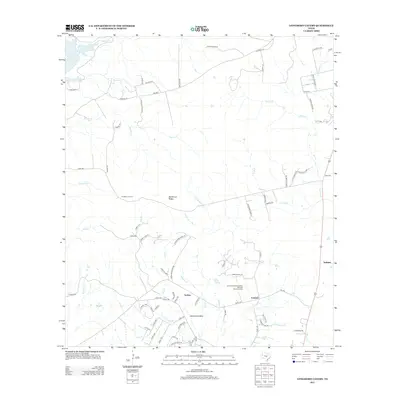
2012 Map of Longhorn Cavern
USGS Topo · Published 2012About this map
Longhorn Cavern serves as a central landmark for this portion of the Texas Hill Country, situated atop Backbone Ridge in an area characterized by complex limestone drainage systems. The landscape is defined by its intermittent waterways, including the winding courses of Honey Cr, Peters Cr, and Mud Spring Cr, which reveal the rugged topography of Backbone Valley. Small rural communities like Fairland and Scobee are linked by local routes such as FM-3509 and Co Rd-100, while the eastern edge of the map follows the corridor of the Austin and Northwestern Railroad Historic District. This rail line, alongside settlements like Sudduth and Demarco, highlights the historical transport patterns that supported the local ranching and mining economy. Genealogists may find interest in the isolated Tobey Cem, positioned near the western slopes where the land begins its descent toward Inks Lake.
Find a feature on this map
83 named features on this map. Tap any name to fly to it.
Don’t see what you’re looking for? This feature index may not catch every label — zoom into the map to look around manually.
Map Details
Editions of this 2012 Longhorn Cavern Map
This is the sole edition of this map. No revisions or reprints were ever made.
Other maps of this area

1887 · Burnet
USGS Topo · 1:125,000

1893 · Burnet
USGS Topo · 1:125,000

1903 · Burnet
USGS Topo · 1:125,000

1909 · Burnet
USGS Topo · 1:125,000

1925 · Burnet 3-b
USGS Topo · 1:48,000
1925 · Burnet 2-c
USGS Topo · 1:48,000

1925 · Burnet 3-d
USGS Topo · 1:48,000

1929 · Marble Falls
USGS Topo · 1:62,500

1931 · Marble Falls
USGS Topo · 1:48,000

1932 · Tow
USGS Topo · 1:62,500