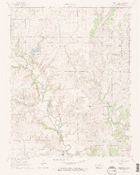
1964 Map of Longton NW
USGS Topo · Published 1965About this map
Elk Falls sits at the southern edge of this mid-1960s survey, marking a point where the Elk River winds through the limestone-rich terrain of Elk County. The landscape is defined by its drainage systems, most notably Hitchen Creek and its many branches, including West Hitchen Creek and Little Hitchen Creek, which carve through the plains. A significant cultural marker is the Old Indian Treaty Boundary, which cuts across the northern half of the map, serving as a reminder of early land divisions in Kansas.
Find a feature on this map
20 named features on this map. Tap any name to fly to it.
Don’t see what you’re looking for? This feature index may not catch every label — zoom into the map to look around manually.
Map Details
Editions of this 1964 Longton NW Map
2 editions found
Other maps of this area

1885 · Eureka
USGS Topo · 1:125,000

1885 · Sedan
USGS Topo · 1:125,000

1888 · Eureka
USGS Topo · 1:125,000

1889 · Sedan
USGS Topo · 1:125,000

1894 · Eureka
USGS Topo · 1:125,000

1939 · Severy
USGS Topo · 1:62,500

1941 · Severy
USGS Topo · 1:62,500

1955 · Wichita
USGS Topo · 1:250,000

1958 · Wichita
USGS Topo · 1:250,000
1962 · Oak Valley
USGS Topo · 1:24,000