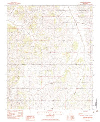
1983 Map of Longtown
USGS Topo · Published 1983About this map
The borderlands of Tate and Panola counties in Northwest Mississippi are defined here by a network of winding watercourses and rural congregations. In the early 1980s, the small community of Longtown serves as a primary hub in the southwest corner, while Crockett sits to the north. The landscape is deeply carved by numerous streams, including Arkabutla Creek, Butterbowl Creek, and Indian Creek, which dictate the placement of roads and homesteads.
Find a feature on this map
22 named features on this map. Tap any name to fly to it.
Don’t see what you’re looking for? This feature index may not catch every label — zoom into the map to look around manually.
Map Details
Editions of this 1983 Longtown Map
This is the sole edition of this map. No revisions or reprints were ever made.
Other maps of this area

1932 · Sledge
USGS Topo · 1:48,000

1932 · Crenshaw
USGS Topo · 1:62,500

1935 · Crenshaw
USGS Topo · 1:62,500

1935 · Sledge
USGS Topo · 1:62,500

1939 · Sledge
USGS Topo · 1:62,500

1944 · Senatobia
USGS Topo · 1:62,500

1948 · Helena
USGS Topo · 1:250,000

1950 · Helena
USGS Topo · 1:250,000

1952 · Sardis
USGS Topo · 1:62,500

1953 · Sardis
USGS Topo · 1:62,500