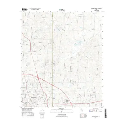
2016 Map of Longview Heights
USGS Topo · Published 2016About this map
Longview and its northeastern expansion, Longview Heights, occupy the rolling terrain along the Gregg Co Harrison Co line in this 2016 study. The landscape is defined by a series of creeks and reservoirs, including Moccasin Cr, Mason Cr, and the Clements Lake Number 1 and Clements Lake Number 4 chain. For genealogists and local historians, the sheet is particularly dense with burial grounds, ranging from Memory Park Cem near the city center to more outlying locations like Alpine Cem, Lily Hill Cem, and Hope Cem. The survey illustrates the modern road network where older rural routes like FM 2208 and FM 2879 intersect with newer residential developments and industrial zones on the edge of the city.
Find a feature on this map
209 named features on this map. Tap any name to fly to it.
Don’t see what you’re looking for? This feature index may not catch every label — zoom into the map to look around manually.
Map Details
Editions of this 2016 Longview Heights Map
This is the sole edition of this map. No revisions or reprints were ever made.
Other maps of this area

1936 · Kilgore
USGS Topo · 1:48,000

1940 · Kilgore
USGS Topo · 1:62,500

1956 · Tyler
USGS Topo · 1:250,000

1958 · Tatum
USGS Topo · 1:62,500

1960 · White Oak
USGS Topo · 1:24,000

1960 · Glenwood
USGS Topo · 1:24,000

1961 · Hallsville
USGS Topo · 1:24,000

1961 · Harleton
USGS Topo · 1:24,000

1962 · Ashland
USGS Topo · 1:24,000

1962 · Longview Heights
USGS Topo · 1:24,000