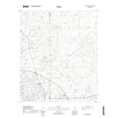
2019 Map of Longview Heights
USGS Topo · Published 2019About this map
The city of Longview dominates the southwestern portion of this East Texas terrain, showcasing the sprawling residential and commercial development within Gregg Co and Harrison Co. The landscape transitions from the urbanized streets of Longview Heights and the industrial activity near the East Side Airport to a more fragmented rural-suburban mix to the north and east. This 2019 survey documents a complex network of residential lanes and local thoroughfares like E George Richey Rd and FM 1844, which weave through a landscape punctuated by numerous family and community landmarks. Genealogists and local researchers will find several burial grounds noted, including Alpine Cem, Lily Hill Cem, and Memory Park Cem. The hydrology is defined by the winding paths of Moccasin Cr and Panther Cr, alongside several named impoundments such as Franklin Lake and Clements Lake Number 4.
Find a feature on this map
198 named features on this map. Tap any name to fly to it.
Don’t see what you’re looking for? This feature index may not catch every label — zoom into the map to look around manually.
Map Details
Editions of this 2019 Longview Heights Map
This is the sole edition of this map. No revisions or reprints were ever made.
Other maps of this area

1936 · Kilgore
USGS Topo · 1:48,000

1940 · Kilgore
USGS Topo · 1:62,500

1956 · Tyler
USGS Topo · 1:250,000

1958 · Tatum
USGS Topo · 1:62,500

1960 · White Oak
USGS Topo · 1:24,000

1960 · Glenwood
USGS Topo · 1:24,000

1961 · Hallsville
USGS Topo · 1:24,000

1961 · Harleton
USGS Topo · 1:24,000

1962 · Ashland
USGS Topo · 1:24,000

1962 · Longview Heights
USGS Topo · 1:24,000