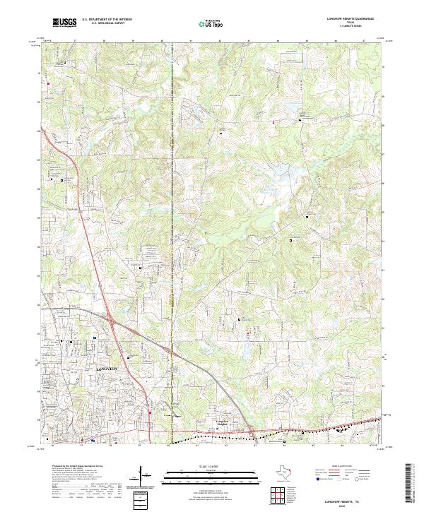
2022 Map of Longview Heights
USGS Topo · Published 2022About this map
The northeastern residential expansion of Longview dominates this landscape, where the transition from dense neighborhood street grids to rural acreage is marked by a high density of small family and church burial grounds. The boundary between Gregg Co and Harrison Co bisects the map, running through a terrain defined by the winding course of Moccasin Cr and Mason Cr. Significant local landmarks like the East Side Airport and Longview Heights anchor the southern half of the sheet, while the northern reaches maintain a more dispersed character centered around water bodies such as Franklin Lake and Cléments Lake Number 4. Genealogists will find this area particularly noteworthy for its detailed recording of numerous cemeteries, including both the Summerfield Cem Old and Summerfield Cem New, as well as several African American church sites like the Pleasant Hill CME Church Cem.
Find a feature on this map
259 named features on this map. Tap any name to fly to it.
Don’t see what you’re looking for? This feature index may not catch every label — zoom into the map to look around manually.
Map Details
Editions of this 2022 Longview Heights Map
This is the sole edition of this map. No revisions or reprints were ever made.
Other maps of this area

1936 · Kilgore
USGS Topo · 1:48,000

1940 · Kilgore
USGS Topo · 1:62,500

1956 · Tyler
USGS Topo · 1:250,000

1958 · Tatum
USGS Topo · 1:62,500

1960 · White Oak
USGS Topo · 1:24,000

1960 · Glenwood
USGS Topo · 1:24,000

1961 · Hallsville
USGS Topo · 1:24,000

1961 · Harleton
USGS Topo · 1:24,000

1962 · Ashland
USGS Topo · 1:24,000

1962 · Longview Heights
USGS Topo · 1:24,000