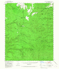
1949 Map of Lookout Mountain
USGS Topo · Published 1967About this map
The Continental Divide winds through this high-elevation landscape of the Gila National Forest along the border of Catron and Sierra Counties. In the mid-twentieth century, this territory was defined by remote outposts and mining legacies, notably several inactive operations such as the Silver Monument Mine and the North Star Mine. The presence of the Boiler Guard Station and Monument Park Guard Station underscores the managed nature of these timberlands, while family names like Kline Place, Santana Place, and the Inman Ranch mark the pockets of settlement and grazing. High-altitude peaks including Lookout Mountain and Boiler Peak overlook a complex network of drainages like Taylor Canyon and Diamond Creek, illustrating the rugged hydraulic patterns that once supported the local mining and ranching economy.
Find a feature on this map
73 named features on this map. Tap any name to fly to it.
Don’t see what you’re looking for? This feature index may not catch every label — zoom into the map to look around manually.
Map Details
Editions of this 1949 Lookout Mountain Map
Other maps of this area

1911 · Alum Mountain
USGS Topo · 1:125,000

1913 · Alum Mountain
USGS Topo · 1:125,000

1918 · Pelona
USGS Topo · 1:125,000

1949 · Lookout Mountain
USGS Topo · 1:62,500

1954 · Tularosa
USGS Topo · 1:250,000

1954 · Clifton
USGS Topo · 1:250,000

1957 · Clifton
USGS Topo · 1:250,000

1958 · Clifton
USGS Topo · 1:250,000

1958 · Tularosa
USGS Topo · 1:250,000

1962 · Clifton
USGS Topo · 1:250,000