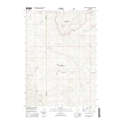
2015 Map of Lookout Mountain
USGS Topo · Published 2015About this map
The divide between the Teton National Forest and Bridger National Forest defines this high-elevation landscape, where the border of Lincoln and Sublette counties runs through some of the region's most prominent summits. Mt McDougal and Lookout Mtn anchor a complex drainage system that feeds water into various forks of North Horse Creek and Dry Beaver Cr. This 2015 survey details the intersection of historic back-country routes and modern trails, such as the Wyoming Range NRT Section K. At Beartrap Junction, the landscape shifts from steep peaks like Prospect Mountain to narrow valleys. Traces of early exploration are evident in names like Silver Mine Cr, while high-altitude travel is marked by Gunsight Pass, a key point for navigating the Wyoming Range.
Find a feature on this map
42 named features on this map. Tap any name to fly to it.
Don’t see what you’re looking for? This feature index may not catch every label — zoom into the map to look around manually.
Map Details
Editions of this 2015 Lookout Mountain Map
This is the sole edition of this map. No revisions or reprints were ever made.
Other maps of this area

1907 · Gros Ventre
USGS Topo · 1:125,000

1910 · Gros Ventre
USGS Topo · 1:125,000

1921 · Afton
USGS Topo · 1:125,000

1931 · Jackson
USGS Topo · 1:125,000

1935 · Jackson
USGS Topo · 1:125,000

1939 · Big Piney
USGS Topo · 1:125,000

1942 · Big Piney
USGS Topo · 1:125,000

1955 · Driggs
USGS Topo · 1:250,000

1955 · Preston
USGS Topo · 1:250,000

1958 · Driggs
USGS Topo · 1:250,000