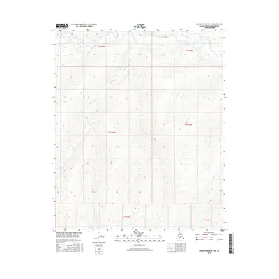
2016 Map of Lookout Ridge B-1 NW
USGS Topo · Published 2016About this map
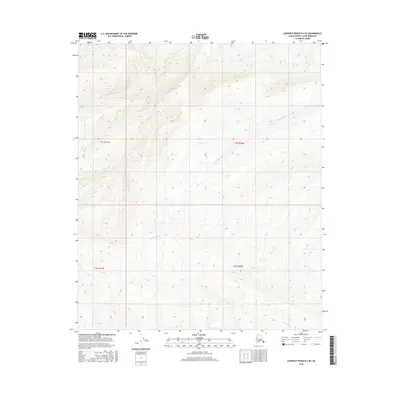
The Titaluk River meanders across the northern reaches of this landscape, its winding course defining the only named hydrologic feature in this portion of the North Slope, Alaska. This modern survey, compiled by the U.S. Geological Survey, illustrates a vast expanse of arctic tundra through tight ten-foot contour intervals, revealing a series of subtle ridges and drainage basins. Organized by the Public Land Survey System, the area is divided into several townships including t2n r19w, t1n r19w, and t1s r19w, providing a clear geometric framework for an otherwise remote and open wilderness.
Find a feature on this map
7 named features on this map. Tap any name to fly to it.
Don’t see what you’re looking for? This feature index may not catch every label — zoom into the map to look around manually.
Map Details
Editions of this 2016 Lookout Ridge B-1 NW Map
This is the sole edition of this map. No revisions or reprints were ever made.
Other maps of this area

1951 · Lookout Ridge
USGS Topo · 1:250,000

1956 · Lookout Ridge
USGS Topo · 1:250,000
1985 · Lookout Ridge B-2
USGS Topo · 1:63,360
1985 · Lookout Ridge C-1
USGS Topo · 1:63,360
1985 · Lookout Ridge B-1
USGS Topo · 1:63,360
1985 · Lookout Ridge C-2
USGS Topo · 1:63,360
2015 · Lookout Ridge C-1 SE
USGS Topo · 1:25,000
2015 · Lookout Ridge C-2 SE
USGS Topo · 1:25,000
2015 · Lookout Ridge C-1 SW
USGS Topo · 1:25,000
2016 · Lookout Ridge B-2 SE
USGS Topo · 1:25,000